Digitally documenting archaeological sites provides high-resolution 3D models that are more accurate than traditional analog (manual) recordings. Capturing the 3D data comes at great financial cost (if using a lidar-based system) or be time-consuming during data collection and post-processing (when using photogrammetry). This has limited the use of these techniques in the field.
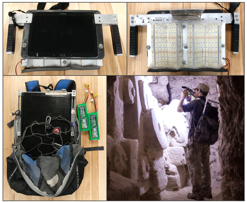
Depth sensors like the Microsoft Kinect and Intel RealSense provide relative low-cost way of capturing depth data. Open-source 3D mapping software provides fast and accurate algorithms to turn this depth data into 3D models. Our research combines depth sensors and 3D mapping algorithms to develop a low-cost 3D scanning system. We analyzed multiple sensors and software packages to develop a prototype system to create large scale 3D model of tunneling-based archaeological site. We used this system to document Maya archaeological site El Zotz in the Peten region of Guatemala. Our findings were recently published in the paper “Low-cost 3D scanning systems for cultural heritage documentation” in the Journal of Cultural Heritage Management and Sustainable Development.
This research is the result of a many year (and on-going) effort between Engineers for Exploration and archaeologists at El Zotz. Congrats to all those involved in this impressive project.